Beara Peninsula – From Allihies to Castletownbere including a Tibetan Buddhist Retreat Centre

Ah, Storm Kathleen. She came, she threw a little tantrum, she left. It was not as bad as we so nail-bitingly feared. No blackouts, no breakages, no unidentified flying objects. Just us, and our forced two days of rest, sitting very safely in the house listening to the wind howling around us. Even though it had been wet and windy a lot since we were here, this was, however, a lot more gustier than usual. We had a lovely panorama view of the bay, the fields and the mountains, so apart from the water being slightly choppier than usual, nothing seemed dramatically alarming. Kathleen did, however, wreak havoc in many other areas in Ireland 🥺

After two days of admiring each other’s baby blue eyes, we really needed to get out and smell the rocks. The sun was shining and no rain was forecast for the day. Hubby has two weather apps. Sure is sure 😎 So the coastal route between Allihies and Casteltownbere seemed like a good idea, and wow, it really was full of lovely surprises.

As we’d already explored almost every part of the coast between Eyeries and Allihies, we didn’t make any stops along the way. Okay, one or two. Maybe more. We approached Allihies from a different route as the last time, and everything was so beautiful. We stopped and explored a bit. Then it was time to eat. Where else to go but to the same pub in Allihies as the last time. What did we eat? Duh-uh! Fish and chips of course. With sides of rugby. The pub was full because a very important rugby match was on. It was so amusing sitting there eating our crispy fish while listening to some very colourful criticism thrown at the TV screen. They say it like it is. It seemed to work because then a try was scored. Boom! Yea! Applause! Way to go Ireland!

As is with a silly navigation app thingy, we were taken on another merry ride. The road led us to the back of the village, adventurous and narrow. The views from above were spectacular, so it was okay almost ending up in a ditch or two to avoid oncoming traffic.

The Pier at Kilkinnikin West close to Loughane Beg Beach with the Black Ball Head mountain at the back. The tower to be seen is a Martello Signal Tower ruin, one of fifty built on the Irish coastline by the British, to hinder Napoleon from invading Ireland. The name sounds Italian, but it was derived from Mortella, a point in Corsica, the birthplace of Mr. Bonaparte. Yes. Seriously.

The Bell Tower at St. Michael’s Catholic Church Kilkinnikin West, Cahermore. The church was unfortunately closed, so we were not able to see inside. As with most of the village churches we had visited up to now, it cannot be ascertained as to when this one was built. The bell tower was apparently erected in the 1950’s.

The most intriguing surprise was to discover that there was a Tibetan Buddhist Retreat a mere twenty minutes away from where we were staying. The Dzogchen Tibetan Buddhist Retreat was a dream come true for an English couple back in the early 1970’s. They wanted to create a spiritual place where everyone would be welcome. Whether you followed any religion, or not, it did not matter. They bought a very large plot of land with some ruins overlooking the amazing Bantry Bay, then started very simply to build their dream. In 1992 they donated everything to a charitable trust, which is still running the retreat up to today. They have a Spiritual Care Centre, a meditation room, a café and gift shop, a hostel and self-catering cottages. A few years ago they started work on building a new temple, and as stated on their website, it will be “Ireland’s first Tibetan Buddhist Temple“. The temple is scheduled to open in the summer, coinciding with their fiftieth anniversary.

We sat for a few quiet minutes in the meditation garden enjoying the views of the shimmering blues, greens and turquoise waters of the bay. The birds were singing and the sun was shining on our faces. Oh what a beautiful serene moment. Then BOOM! Gaudy loudness. A group of tourists. Was it really necessary to shout down the mobile phone? Did the others in the group have to laugh and talk as loud as they did? Were they calling their spirits? Did none of them see the sign asking to respect the garden and be quiet? Geez! The same when visiting churches. Some people have no respect whatsoever. Rant over!

The Brackluin Animal Sanctuary and Rehabilitation land is right next to that of the Dzogchen Beara. We tried to walk there, as seeing all the animals that were rescued would have been very interesting, but the ground was a bit too mushy for our liking, so we gave up. We visited the café instead and had cake with hot chocolate filled with marshmallows and thick cream 😋

Gour viewpoint with great view towards Castletownbere

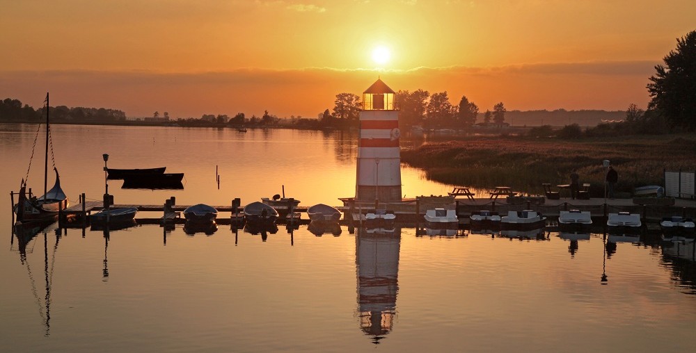
A day filled with lots of walking, driving, fresh air, sunshine and dazzling colours. We got home, sat ourselves on the sofa and waited for the sun to set. Oh bless…

Beara Peninsula – Travaud Beach

We were starting to get a little bit scared now. A storm was brewing and she was threatening to hit Ireland with a vengeance. She. Storm Kathleen. For over a week it was topic number one, on TV, in the shops, in restaurants, everywhere. Hard to ignore. Hard to avoid. At first the news was so dire that we thought it might be the end of our holiday. The two of us would be flying back home, or wherever the wind would be taking us, while still holding onto the sofa. Oh my! Oh my! The imagination be going all cooky. Then Kathleen got relegated down to storm level orange. We breathed a sigh of relief. It did not stop us though from questioning the owners about how stable their house is. Do you have a bunker thingy? A tunnel? Will lambs fly? No. No. And no. The house has been through many storms, so don’t worry, you’re safe. Ok. Thank you. We collected all the candles, lighters, and torches, charged our mobiles, packed food. The media was in a sort of frenzy now. And us? We were as calm as all the lambs making noises in the fields. So there!

So the day before Kathleen was to arrive, we went on a last and quick little outing before all hell broke loose. The Travaud beach was not so far away from us, so we went there. We expected to be staying indoors for at least two days during the storm, so a breath of fresh cold sea air was needed before that.

It had been raining a lot, and still was, so there were big puddles of water everywhere on the fields. The only time since we were there that it was so much. If it carried on like this we could probably swim down to the bay.

Travaud beach is rocky and pebbly, but the water looks calm enough to swim in it. A very rusty boat winch, could not see how old it was, stands there abandoned.

Rocks have interesting shapes, but quite slippery.

The beach is shaped like a semi-circle, with fields wrapped around it, and behind that, a range of mountains. And cows, giving us the eye…moooo!

Beara Peninsula – Castletownbere

Castletownbere, known as the castle town of Beara, is a large-ish town and also the nearest to where we were staying. The castle that it was named after no longer exists, but the town itself is very charming, and for us, there was quite a lot to see. Castletownbere has the largest fishing port in Ireland, is also a natural harbour, the second most safest in the world. A busy town with a very good infrastructure. Parking, shopping, eating. Especially eating. There are many pubs, cafes and restaurants, even take-aways, hmmm roast chicken, and all within walking distance. The locals are helpful and friendly too.

There are two islands not far off from Castletownbere, Dinish Island and Bere Island. Dinish Island is the smallest one, only about forty five acres and about half a kilometre from the town. A bridge connects the two (see first photo) whereas Bere Island, the much larger one, it is only possible to get there by boat.

The town is colourful, with lovely painted houses, tables and benches.

Titbit: MacCarthy’s Bar was first built in 1860 and was one of the first establishments to get a liquor licence in Ireland.

Just a bit out from the town centre is a lovely walk along the water towards the Aghakista Bridge and Millbrook Bar.

Here are a few amusing things we found in trees, gardens and along the road. 🤭🫣

Saint Peter’s Church Castletownbere, built around the 1840’s, is/was an Anglican church. We were not able to view it from inside, as it was completely fenced in and seemed abandoned or maybe had not been in use lately.

Church of the Sacred Heart, Castletownbere, built in the first few years of 1900, and elevated up from the main street, is a Roman Catholic Church, still in use today.

After a well-earned lunch, we did a bit of shopping then headed home. It wasn’t long thereafter when brown stuff started flying. We’re not sure if it was manure or not, but let’s just say that the grass is still green…😆

Beara Peninsula – Ruins of Kilcatherine Church and surroundings

We spent Easter Sunday at home indulging in the best home-made roast with a cheesy potato gratin. Yes. Hmmm. Delicious. And made with love by the sizzling chef himself. Come Monday and we were so ready to walk somewhere. Nothing adventurous, just a quick-quick, get some fresh air then back home walk. The cliffs and hills across the bay from our holiday rental looked like a good option, so off we went. A ten minute drive. Empty roads. Beautiful weather.

Ruins of Kilcatherine Church – The ruins of this church dates back to the twelfth century and was built with stones from the local area. The church is east and west facing, with the altar, as with all churches built in this era, facing east. It sits on a hill overlooking the bay. There’s also an underground structure with three chambers that probably dates to a much earlier period. These chambers are called souterrains, archeologically unique to Ireland. These ones here have been filled up though.

The carved stone head protruding above the entrance to the church is thought to be a symbol to ward off evil. This one has a long neck, apparently quite unusual for this type of carving. We almost did not see it, as it’s almost smooth and not so detailed anymore.

The church is surrounded by a graveyard, with a mix of older and newer headstones. There is a carved stone cross at the back, a little in front of the souterrain that is much, much older than the church itself. It’s also weather beaten and no engravings can be seen. Amazing!

Views from Kilcatherine Church over the fields and towards the bay.

We wanted to explore the surroundings some more, so walked. And walked. All the way to the end. Only three kilometres. One way. We ate enough easter eggs so had lots of energy. It’s a lovely walk. All we had to do was lean on a fence so that a big tractor could pass, and stand still because a dog was getting too excited and sniffing too close for comfort. This is the way to Kilcatherine Point.

Lakiri Chattan – the views at the very end of a long dirt road. A few muddy puddles. An Irish hare. No sheep. Quiet. A refreshing walk. Oh what a beautiful day….

Beara Peninsula – Eyeries Loop Walk – Sheep, sludge and stones

We just wanted to take a little walk down to the strand in Eyeries. It was not too far from the centre of the village, and as we were a wee bit tired from all the walks and driving around of the previous day, we needed a bit of a rest. A fifteen minute relaxing walk to the strand seemed to be a good idea. It was. Then it was not. Then…

Sheep. Lambs. Oh so entertaining. One little lamb was a concern though as it seemed to be lost. It was looking for its mother, going from sheep to sheep, but kept getting pushed away. It then seemed to give up and just plopped down and laid there softly bleating. Even though we wanted to know if it’ll be alright, we had to continue our walk.

At this point it was a wonderful and easy walk, helped along by some strong wind 🤭

When we reached the strand, the sun was shining again. We will not talk about how we were hit by ice pellets. How we ran behind sheep. They probably thought we were chasing them but no, we were running for cover. There was no cover, not even a tree, but we ran anyway. 🤷🏻‍♀️🤷‍♂️ Other than that, it’s an interesting little strand with a lot of pebbles and sea shells.

We decided to walk a bit further instead of turning back. Just a little look-see. We plodded on then discovered that this was part of the Eyeries Loop Walk. Very muddy dirt tracks. Blobs of water everywhere. Fences to climb over. Yay. We were really not dressed for this. Wrong shoes. Wet clothes. Whatever. There was no turning back, so onwards we went. So us. Typical 😂

The views, people, the views. We can highly recommend this walk.

It took us longer than fifteen minutes to loop, of course it did. There is so much to see and do along the way. Watch lambs. Run. Find cute pebbles. Frighten birds. Sorry. Avoid sludge. Does not work by the way. Hug. The views. Sigh. Life is good. Climb fence. Hop over puddles. Wade through water. Dang. Resolve to buy wellies. Again. Question our sanity. Laugh. We good. Slip. Climb another fence. The last one. Crunch on gravel. Hallelujah. Hold hands. Reach village. Call the spirits. Go to pub. Drink whisky. Forget about wellies.

Beara Peninsula – Allihies

It is a long, winding and mostly narrow road between our holiday rental and the colourful village of Allihies. Technically, it’s only a twenty minute drive, but because it’s so beautiful and scenic, it took us much longer to get to Allihies. We wanted to stop everywhere along the way, but it’s quite difficult to find a spot off from the roadside to park just there where the views are the most amazing. There were two or three, so we got out to explore, aka climb rocks, or to take a little walking tour, aka climb fences. Other than that, as we were snaking through the mountains, we managed to take lots of photos from the car. It was very safe, especially since we were the only ones on the road at the time. Also, the photographer had his camera poked out of the window. Think drive by shootings. Click-click, me dears, click-click. Not bang-bang-pew-pew.

We used the R575 road to Allihies. In good weather the views are very ooh and aah. Stunning!

Here are some picturesque houses along the way, with lavishly green meadows and sheep at the most western point of R575 of the peninsula.

Trá An Phéarla (Strand of the Pearl) – this is a very rocky beach/strand. We walked it, uhm, we wobbled and almost lost our balance quite a few times trying to get near to the water. The views from behind the cliffs are what we wanted to see. Or maybe the leftovers of a shipwreck? There’s a song written about this stony strand, Trá An Phéarla. It’s about the Pearl, a ship that sunk here in the seventeenth century.

Beara Bowl – shortly after the cove, above, as you drive downwards towards the coast, there is a large-ish “parking” space on the left of the road, directly on a curve. There’s a big stone in the middle with three sort of short walls right next to it. If you see it, stop and park here. A short walk down the road and there it is, one of the most photographed rock formations in Ireland, the Beara Bowl. As you can see, it’s really shaped like a bowl…This is also a lovely spot to take in the surroundings. Water, mountains, fields. A palette of magnificent colours!

Dooneen Scenic Viewpoint – just one curve after the Beara Bowl is this viewpoint. It is not far from Allihies, and is also near to an old Copper Mine abandoned in the late 1870’s. There are views of the sprawling coast to the front and the mountains at the back. A ballad, The Cliffs of Dooneen, sung by a famous Irish singer, apparently is not about this Dooneen, but worth a listen anyway.

Allihies Mountain Copper Mine Shaft – This area had the largest copper mining industry in Ireland before it had to close down after seventy two years. A visit to the Copper Mine Museum in Allihies is a must for information about the area. After Dooneen view, the next turn to the left is towards the village of Allihies. Half a kilometre before that you will see the copper mine shaft sitting on the mountain like a boss. To the left is the view of the village. From here one can also walk the Copper Mine Trail. Climb over the fence and up the mountain you go…easy. Be careful though, because it can be quite soggy after lots of rain. See the rain cloud over Allihies??

Ballydonegan Beach Allihies – this beach is unique not just for the cute houses, or the views but for its sand. It’s rougher and more shimmery than the finer sand one would find elsewhere in the area. A non-stick skin peeling kind of sand, apparently due to the crushed quartz stones washed down from the old copper mines.

Allihies Village – what a colourful little village! Despite its size, we were so pleasantly surprised at how lively and busy it was here. After a lovely walk through the village, we lunched at one of the two pubs there. Our first fish and chips since being in Ireland. Deee-lumptious! As one of us is blessed with ample-ness, it was a tight squeeze to get through their tiny narrow door though. Before and after. Just saying 😆

St. Michael’s Church

Beara Peninsula – Boggy walk to Ardgroom Stone Circle

It had been raining quite a lot, and today was the first day filled with sunshine, so we debated as to where to go. Using the word debated quite loosely over here. One of us plans. Where, when, how. The other one leaves it up to him because he always chooses the best excursions. Always. And the trips are on a timeline, because, just because, and also of weather conditions. The other one would just leave the house, and late too, not like after breakfast, but the there’s no rush kind of late. Then we’d randomly stop somewhere to admire the thingies. What’s that thingy over there? A thingy just moved. Ooh, look at that thingy. OMG! A thingy! So no. Proper trips need to be planned. We were off to the Ardgroom Stone Circle.

In all the times we’ve been to Ireland, there was not one stone circle we had visited that was sitting prettily next to or on a paved or gravelled area. Nope, they were always in some field or other. So we debated. The ground is going to be too wet. No, the sun is shining. Yes, but the ground is still wet. No, there’s a road. Okay, you win. Let’s get to this road.

It’s not difficult to find the stone circle, there are markers everywhere. The only itsy-bitsy issue we had was whether to drive up the narrow lane or not. We were not sure about parking, or if it would be possible to turn around. Someone cannot drive in reverse, even when parking. So we left the car on the side of the main road and walked up. Turns out that there is parking and much nearer to the stones. Three cars have ample space, but we found that the walk up was way nicer, especially because of the views.

It had snowed during the night, and the mountain tops were still covered in snow. It was a bit chilly, but that was nothing compared to the adventure getting to the stone circle. Let’s just say squish-squash-yelp. It went well up until we had to cross the field. The sun is shining he said, yeah, well, the ground did not get the memo. It got worse after we climbed over the fence, but we managed to get to the stones. Somewhat dry, and chuffed at our balancing skills. There were lots of sheep. Unimpressed. Staring. Like crazy humans stares. They did not määä. They left us to take in the serene quietness of the area. Mountains. Fields. Streams. Sea. Blue skies. What a wonderful panorama!

There are eleven stones in the circle, eight tapering and upright, quite unusual, one lying down, and one set a bit further apart from the others, outside of the circle. They’re said to be around three thousand years old, like so many of the other stone circles in Ireland.

The sheep knew what was coming, that’s why they left us in peace 😂🤣. It was a very wet and sludgy walk back. We thought it would be better to avoid walking the way we came, but hell no! it was worse. It’s like we got heavier the thirty minutes we were there, because every step we took ended up in making shoe size craters. One of us thought she was clever and walked along the little stream, making sure to only tread on tufts of grass. One gave way and in she plopped. The mud was extremely slippery and sticky. It was quite a mission to get both foot and shoe out. Oh, where were the wellies when one needed them? Giving up, we just squished, squashed and squelched along. The main thing was to get outta them fields. Phew! Made it. This is what the feet looked like AFTER trying to get the muck cleaned off. It could’ve been worse, but for us it was still a fun day. We love our adventures 🤪

Beara Peninsula – The beginning…

It was a very long travelling day. We woke up at 2am. Two. After. Midnight. Our driver to the airport was picking us up at three. Geez! Who books such early flights? Okay, never mind. We did not sleep much. We were visiting our friends and sat there lost in hearty conversations and merry times with creamy spirits until it got dark, like hey, no problem, no stress, we’ll still get enough sleep. Nope. Two hours, that was it. Whateverrrr. Off to Ireland we go!  One of us purred in the car, women don’t snore, then purred all the way from Lisbon to Dublin. Even though we took off forty minutes late, we still arrived as scheduled. Fáilte! Welcome.

Then it was waity matey from then on. It took almost an hour before our bags arrived. We were sharing a carousel with another airline. Their bags were coming out in dribs and drabs, like one every minute or so, so we had to wait until the last one traipsed in. Neon green. Ta-daaa! Ours came out quick after that. We rushed to the car rental, but had to wait. Another almost hour. Two staff, a long queue and a very wanting to know everything person in front of us, whose credit card also did not work. No matter. We have time. Besides, random chatting with strange people in an airport is also a fun pastime. Our turn. Our credit card worked. We were given a voucher. No car keys. These were a shuttle bus away. At the other end of the airport. The car was not ready. Heh? Yes madam, it still must be checked. Wait. Wait. So it didn’t matter that we booked a car more than two months ago. If it ain’t ready, it ain’t ready. Choc chip cookies to the rescue. Crunch. Munch. Munch. An hour later we had a car! Goooood morning.

Traffic. Wrong side of the road. Passenger on the pavement. Passenger on the pavement. This mental mantra only works if there ARE pavements. Roundabouts and highways are another story. So you just drive and let everything overtake you. Once we left busy Dublin, it got easier and the passenger to the left kept us on track. Stay left. Change gears. Indicate. She obeyed. He was in man heaven. Then he got finicky. Did you just scrape the bush? Watch the bush. I almost landed in the bush. Ohmmm! Passenger in the bush. Passenger in the bush.

We still had five hours to drive until our destination, but we had to stop and buy groceries, and eat. Driving was now quite pleasant, especially when we hit the narrow and curvy rural roads. It was impossible though to keep up with the speed limit of 80 or 100 km/h, so we just ambled along and tried to enjoy the beautiful scenery, forcing the other ten or so cars stuck behind us to do the same. They seemed to understand, because no-one flashed their lights or toot-tooted. The very large rental company logo on our rear window explained everything.

We arrived at our destination on the Beara Peninsula at around seven pm, in the dark, and with rain pelting down. Määä-äää. Sheep welcomed us. After unpacking, finding our way around all the bits, bobs, and choosing which bedroom to sleep in, there are four, we plopped into bed at ten. Oh. Happy. Day!   

A day with lots of rain was forecast. No problem. After a hearty breakfast we were raring to go. Our surroundings needed to be explored. First up was our lovely neighbour, Mr D. Very friendly. Very informative. Lots of interesting sheep talk. It’s lambing season and while we were chatting, a ewe in the field over the road gave birth. Mr D took us into the field to see this wonder of wonders. We kept a moral distance just looking and marvelling, also using the camera zoom to take some photos. It was a mother and child moment and we were loathe to disturb that. Mr D also showed us another ewe with her twins. They were born a few hours earlier, and we arrived almost at the same time, so why not name them after us, he said. What an honour that would be! Here they are. The thirsty one, glugg-glugg-glugg, and the curious one. Fits, or not? We are living on a sheep farm, so more lambs will be born. Twelve so far, and counting.

We are within walking distance to any point of the bay in front of us. Some could be more than an hour away, some just up the road. We opted for both. What were we thinking???

Travara Bridge

This one is the nearest to us, so we went there first.

Travara Strand / Travara Beach

Beaches are called strand in Ireland. These are beautiful! And we were all by ourselves too…

Travara Pier

Quiet. Peaceful. Clean public toilets.

Coulagh Beach

Ballycrovane Ogham Stone

Again. What were we thinking? All that rain but no, we had to climb up to see this. A slalom through long wet grass, pools of water and lots of thick, soft gooey mud. The long legs went tumbling down. No worries, it was a soft landing. The shriek was more from shock than ow-ow. But as you can see, a stunning view…

Ballycrovane Pier

We met a lobster fisherman who was bringing in all his nets because the season was over.

Eyeries

This is a very colourful village near to where we are staying. The only village. They are so nice and friendly over here. We walked around a bit then treated ourselves to a toasted sandwich at the general store, with delicious hot tea. When in Ireland…

St. Kentigerns Catholic Church

Two non-pilgrims marveling at Santiago de Compostela

We don’t just love nature and hiking. No, one or two city tours, churches, cathedrals, castles and palaces can occasionally motivate us to temporarily lift our bum from the dent on our couch at home. Said and done – during a three week vacation in Galicia in June we happened to visit Santiago de Compostela.
Since one of us had always wanted to do the Way of St. James, years later we started walking from our home, and at least made it through Germany and Switzerland to the French border… but that’s another story.

Santiago de Compostela is the capital of the autonomous community of Galicia, in northwestern Spain. The city has around 96,000 inhabitants and is the location of the University of Santiago de Compostela.
The city has its origin in the shrine of Saint James the Great, now the Cathedral of Santiago de Compostela as the destination of the Way of St. James, a leading Catholic pilgrimage route since the 9th century. 
In 1985, the city’s Old Town was designated a UNESCO World Heritage Site.

When we came to Santiago de Compostela we didn’t know much more than that the city is the destination of the Way of St. James. It was only during our stay in the city and later research that we learned more.
One of the first things that we saw was the pilgrim statue inside the Parador de Santiago de Compostela.
Carved on all four sides of the sculpture outside the pilgrims’ museum in Santiago de Compostela is the quote: “Camino recto, camino erguido, camino buscando un sentido. Camino porque tengo un objetivo, y no pararé hasta alcanzar mi destino” (I walk straight, I walk upright, I walk looking for meaning. I walk with a purpose and I won’t stop until I meet my destiny).

James the Great was one of the twelve apostles, son of Zebedee and Salome and brother of John. Salome was a sister of Mary (mother of Jesus) which made James the Great cousin of Jesus.
According to the New Testament, he was the second of the apostles to die (after Judas Iscariot), and the first to be martyred. According to the Bible, he was beheaded on the orders of King Herod Agrippa I of Judea in the year 44.

Saint James is the patron saint of Spain. The cathedral is his reputed burial place. 
An even later tradition states that he miraculously appeared to fight for the Christian army during the legendary battle of Clavijo, and was henceforth called Santiago Matamoros (Saint James the Moor-slayer). 

The main focus of our sightseeing in Santiago de Compostela was the Cathedral which has historically been a place of pilgrimage on the Way of St. James since the Early Middle Ages and marks the end of the pilgrimage route. Construction of the present cathedral began in 1075 under the reign of Alfonso VI of Castile. The building is a Romanesque structure, with later Gothic and Baroque additions.

After spending one or two hours in the Cathedral we continued our sightseeing with some other famous locations.

On the square (Plaza del Obradoiro) in front of the cathedral is the Pazo de Raxoi (Palacio de Rajoy) (see pictures top left and top right). The palace was completed in 1766. It has a neoclassical facade, resting on an arcade made up of 14 semicircular granite arcades. Originally the building was used as a seminary for confessors, but today it is the headquarters of the town hall and the government of Galicia.
The monastery of San Martiño Pinario (second picture from top on the left) was a Benedictine monastery. It is the second largest monastery in Spain. Little remains of the original medieval buildings, as the monastery has been largely rebuilt since the sixteenth century. The buildings currently house a seminary.
The Chapel of São Frutuoso (third picture from top on the left) is a Churrigueresque style temple, next to the Plaza del Obradoiro. It was designed by Lucas Ferro Caaveiro in the 18th century.
Quintana Square (second picture from top on the right) is the main square of Santiago de Compostela. The area of Quintana Square was once a cemetery. The square was built around 1611, following the decision of the Mayor of Compostela to convert the medieval cemetery known as Quintana de Mortos into a public square.
The Casa da Parra (third picture from top on the right) was built in 1683 by Domingo de Andrade from granite blocks with a tiled roof. The last floor was added in the 20th century.
During our visit we also listened to an Asturian bagpiper, strolled through Villar street in Santiago und went inside the Parador de Santiago de Compostela (Hospital dos Reis Católicos).

We hope to reach the end of the Camino de Santiago on foot and return to Santiago de Compostela – a beautiful city.

After our excursion to Santiago de Compostela we returned to our Hotel “Pazo Los Escudos” in Vigo and enjoyed this fabulous sunset from the balcony of our hotel room.

Autumn leaves in a moorland in Upper Swabia

About 25 km from our home in Upper Swabia lies the Wurzacher Ried, one of the largest nature reserves in Southern Germany north of the municipality of Bad Wurzach in Baden-Württemberg. It was awarded a premium by the EU as a European bird protection and fauna-flora-habitat area.

During the past three ice ages, the mighty forces of the Rhine glacier steadily formed the hill chains of the Allgäu and carved out a deep basin that existed from around 10,000 BC and gradually became a moorland.
The moor area has been endangered by draining and peat cutting over the last 300 years. However, renaturation and waterlogging measures have been taking place for some time. The Wurzacher Ried is predominantly a raised moor that continues to grow and is only wetted by rain. The largely untouched core area, which covers around a third of the moor area, is the largest contiguous and still intact raised moor in Central Europe.

For us, the Wurzacher Ried is one of the most beautiful hiking opportunities in the surrounding area. We usually park at parking lot 1 and then walk around the section called Haidgauer Ried. No, we had no intention of looking for bog bodies or becoming one ourselves.

The photographs in this post were taken in two different years between middle and end of October.

Our usual hiking trail first passes a lake. The Riedsee is a relic from the times of peatland mining. At around 10 hectares, it is the largest body of water in the Ried.
We enjoyed the wonderful autumn atmosphere and marveled at the reflections of the trees in the lake.

The path repeatedly leads past standing water and water-filled ditches in which the vegetation is reflected. Reeds and birch trees grow on the bank. Past Riedsee, peat nature trail, peat museum and peat rail way we reached the Haidgau spring lakes viewing platform.

Underfoot, the ground bounces gently with every step. The path then leads over narrow wooden footbridges and boardwalks. Dark water shimmers between thick sedge grass. The trees form tunnels through which the hiking trail leads. Except for the lively chirping of birds and gentle rustling in the treetops, it is quiet.

The landscape is beautiful. A carpet of moss behind a wooden bench. Hay bales in the fields adjacent to the nature reserve and a view of the town of Bad Wurzach with the Roman Catholic Church of St. Verena.

In autumn the red berries of the viburnum (Viburnum opulus) shine and many different mushrooms grow along the path.

Some fields had not yet been harvested. Occasionally there were even butterflies to be seen… and of course autumn leaves everywhere.

The hiking trail leads past the village of Dietmanns. A chair was carved from a tree trunk. Graphic patterns of high-voltage pylons and autumnal greenery surprise the attentive observer. The Wurzacher Ried is definitely worth a visit in autumn.